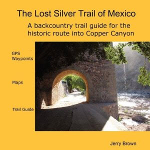
The Silver Trail Itinerary 2011
Silver Route
As it crosses Copper Canyon,The Silver Route is sinuous and dangerous. The path that travels towards Carichí from the village of Batopilas covers a distance of approximately 200 km (124 mi), crosses three rivers and numberless canyons, including the one that bears the name Copper, and also the Continental Divide. The average accumulated gain in elevation is 6,600 mts (21,600 ft) and the decline is about 5,300 mts (17,380 ft). The stations constructed by the Batopilas Mining Company in the section from Batopilas to Carichí were seven, and number from the start as: Potrero, Teboreachi, La Laja, Pilares, Guajochi, Bacaburiachi, and Carichí. The stations were constructed of dry-stacked stone or adobe, and consisted of three rooms where food, cots, and blankets were stored for use by the arrieros (mule drivers). They were administered by a guardian who made sure there was hot food for the muleteers and feed for the pack mules of the silver convoy.
Itinerary for the 2011 Silver Trail:
October 7: Gathering in Batopilas
October 8: Batopilas
October 9: Batopilas to Potrero
Maps: Samachique G13A32 1:50K, LaBufa G13A42, Batopilas G13A41 1:50K
The departure of the convoy occurred at 12:30 midday, the 9th of October, towards the first station on the route where one arrives after approximately 3 hours of travel from the village of Batopilas and a distance of 12 km (7 mi). The station bears the name Potrero and is located across the river from the road which goes to Batopilas, and was built as an annex to the mission called Jesuita del Potrero. An interesting anecdote is that the television chain “Televiso” filmed their series “Tradiciones” at this site owing to the fact that it is an important ceremonial center for the indigenous people. The route continues along the river on the eastern edge of the Batopilas Canyon cliff walls until arriving at the station, which was constructed of dry-stacked stone alongside of the old adobe mission. Potrero Station was a secondary station of the Teboreachi Mission, and was used only when the convoy departed late from Batopilas and could not reach Teboreachi in one march, or when, on the return trip, they arrived short of Batopilas and it became necessary to pass the night en route.
The fiesta took place with happiness and jubilation; feelings that emanate from the pride of recognizing a tradition so deeply rooted in our culture. The community of Batopilas bade farewell to the arrieros who carried their freight in the form of silver and a message of brotherhood from this village in the Sierra that wants to show the world its dignity and honesty, qualities which embrace the character of all the mountain people. The beauty of the canyons was the backdrop for this event which so represents our traditions; the working of mules is tied to our history as an intrinsic element of Mexican culture. It forms part of the popular image which cannot be forgotten, and bedrock values which are ours.
The number of arrieros was 29, of which some were of foreign nationality, coming from countries as far away as Brazil. Pilar Pedersen, a North American and veteran of the silver convoys, looked content knowing she was part of this group who consider themselves as brothers. Cecilia Domínguez and her daughter Úrsula, Rarámuris from the municipality of Carichí, led the Silver Convoy 2011 bearing the white flag of the muleteers of Copper Canyon.
The Presidente (mayor) of Batopilas thanked with emotion the institutions involved in the organization of the event such as: The Congress of the State, represented by Deputy Brenda Ríos; the Department of Tourism; the State Coordination of the Tarahumara; and the other municipalities supporting the conducta (convoy). The representative of the Presidente of the Municipality of Chihuahua, The Honorable Mr. Herrera, transmitted a message of solidarity from the Presidente of Chihuahua, Marco Adán Quezada, to the people of the Sierra and plains of our state.
October 10: Potrero to TeboreachiMaps: Samachique G13A32 1:50K, La Bufa G13A42, Batopilas G13A41 1:50K
Teboreachi Station is located in a hollow of the high Sierra at an elevation of 2,000 mts (6,500 ft) above sea level. Its construction is of dry-stacked stone and adobe, and it is situated on one side of the Arroyo Recochare. This march is covered in one day’s ride from Potrero Station with an accumulated ascent of around 1,900 mts (6,200 ft). The distance between stations is about 25.4 kms (15 mi) and is traveled in roughly 8 hours. The path crosses through the indigenous communities of Huimaybo and Coyachique, and exposes one to some of the most spectacular vistas on the Silver Route.
The trail that arrives at Teboreachi Station climbs the western slopes of Batopilas Canyon to arrive at Pandito, a rest stop for the silver convoys, after which and a bit further on one arrives at Infiernito, a stretch of the path known both for the drama of the landscape and the danger of the trail. The peaks of the high Sierra with their serene beauty, and the scabrous depths of the canyons contribute to the voyage of the Silver Route, which on this stretch of trail reveals some of the most stunning views of the journey.
11 Octubre Teboreachi – La Laja
Mapas: Samachique G13A32, La Bufa G13A42
One encounters La Laja Station located on Highway 23 at an approximate distance of 12.7 km (7 mi) from the Batopilas-Guachochi junction. The route between stations crosses the high Sierra at a mean elevation of 2,250 mts (7,300 ft), with an average accumulated descent of 860 mts (2,800 ft), and 1252 mts (4,100 ft) of accumulated elevation gain.
The alpine vegetation of pine and oak make the passage one of the most pleasurable and relaxing of the voyage. The distance between stations is 32 km (19 mi).
October 12 La Laja – Pilares
Mapas: Samachique G13A32.Norogachi G13A33
Pilares Station is located 18 km (11 mi) west of the settlement of Norogachi. The distance between La Laja Station and Pilares is 43 km (26 mi). An interesting fact is that the junction of the Urique River and the Copper Canyon is found in the municipality of Guachochi, in the village of Siguiriche, right at the entrance to the marvelous Valley of Churches with its spectacular craggy formations. The accumulated elevation gain is 845 mts (2,770 ft), and the descent is 749 mts (2,450 ft). The path travels the high Sierra at the elevation of the pine and oak zone. The route passes through the indigenous hamlets of Tatahuichi, Raoseachi, and Siguirichi.
October 13 Pilares – Guahochi
Maps: Nararachi G13A23 1:50K, Norogachi G13A33 1:50K
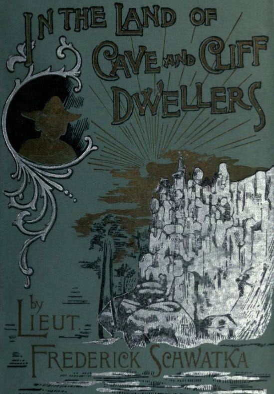
This day’s march travels through one of the most singular landscapes of the Silver Route, the Valley of Churches with its rock pinnacles forming majestic towers which rise up haughtily along the length of the Cicochi Valley, and as Frederick Schwatka described in the 19th century in his book, “In the Land of Cave and Cliff Dwellers”, “It is one of the most picturesque landscapes in the Sierra Madre Occidental”. Here is where Antonin Artaud, the French poet and playwright, discovered on his esoteric trip around the world the magnificence of the Rarámuris inside one of the many caves of the inhabitants of the community of Nanárachi. The trail has an elevation gain of 412 mts (1,350 ft), and an accumulated descent of 840 mts (2,750 ft). The distance between stations is 38.8 kms (24 mi). Guahochi Station is one of the best preserved and, in its setting, certainly the most beautiful. The station sits on the banks of the Conchos River in a bend of the canyon, garnished by enormous cliff walls in the shape of a half moon.
October 14 Guahochi – Bacaburiachi
Maps: Carichi G13A13 1:50K, Nararachi G1A23 1:50K
Bacaburiachi Station is located 26 km (16 mi) from Guahochi Station at an approximate elevation of 1,900 mts (6,200 ft) above sea level. The station served as an intermediate resting stop or was used for reprovisioning. The path is well marked in places, but in others gets lost in vegetation or cultivated parcels of land. In some stretches one can follow the track that the mules left in their passage over hundreds of years in the rocky mesas of the high Sierra. This stretch of trail carries an accumulated descent of 105 mts (340 ft), and an accumulated climb of 1,246 mts (4,080 ft). Bacaburiachi is located 20 km (12 mi) from Carichí, and has access by vehicle. As a tourist attraction one may visit the thermal waters with available lodging in mountain cabañas.
October 15 Bacaburiachi – Carichí
Maps: Carichí G13A13 1:50K, Nararachi G1A23 1:50K
The route along this portion is short and simple and its passage is one of the most pleasant and relaxing on the Silver Trail. The lower slopes of the Sierra Madre Occidental covered with junipers and oaks make the landscape a picture postcard of the mountainous region of Mexico. The distance of this leg is 20 km (12 mi) and mostly follows dirt roads until arriving at the village of Carichí.
Carichí was founded the 18th of November, 1675, by the Jesuit missionaries Tomás de Guadalajara and José Tardá, and became a departure point for the process of evangelizing the high Sierra. Commerce originating from the Pacific, hauled on trains of mules across the Sierra Madre Occidental, overnighted in this village on their way to the City of Chihuahua.
Today’s arrieros came down from the high Sierra to continue their journey across the grasslands and plains of the Chihuahuan Desert. The Municipal Presidente of Carichí, Ignacio Varela Ortega, gave them a warm welcome and cheered the spirits of the tired muleteers with an open-air celebration enlivened by a traditional ranchera band, typical of this area. From this point onward the silver will be transported in wagons driven by the valiant arrieros continuing the journey towards the capital of the state, and pulled by the indefatigable mules. The ceremonial act of receiving the precious mineral is a testimonial to the importance of the mining industry in our state and its contribution to the economy not only to the state of Chihuahua, but the entire Republic. The Presidente remembered the importance of his town as a commercial center during past centuries and also celebrated the effort of the government on behalf of the full State Congress to issue the declaration of the Silver Route as Cultural Patron of the State of Chihuahua – not only because of its significant socio-cultural and historic relevance, but also because of the regional cohesion it has created which benefits the larger society.
October 16 Carichí – Cusihuiriachi
This day’s march was the longest of those up until now and was completed in a time of 10 hours. The mineral riches of Cusihuiriachi were discovered in 1687 and its historical relevance is connected to mining activity. The journey which marks the Silver Route in its passage through this famous mining locale highlights its historic legacy, underscoring it as one of the most important mining centers in the state of Chihuahua and on the mission route of the Jesuit Order. The Mission of San Bernabé was founded in 1674 as part of the missionary advance towards the high Tarahumara (mountains). Cusihuiriachi was also the meeting point of the roads which arrived from the mining areas of Batopilas and La Purisima (today called Guerrero).
The celebration of the arrival of the convoy took place in remembrance of the importance of mining activity, past and present, in our state. There was a strong reference to the relevance of this event as an example of the necessity of rediscovering the historic value of our mining origin and also the roots of our ranching culture.
The arrieros were witnesses as they journeyed over the plains of our state one hundred years after the epoch of the Silver Convoys coming from Batopilas, to the labor and effort of the Chihuahuan people, who have transformed the rugged landscape into marvelous fields of cultivation.
October 17 Cusihuiriach – Cuauhtémoc
The Silver Route converges with that of La Manzana in the 20 kms (12 mi) that lie between the village of Cusihuiriachi and the city of Cuauhtémoc. History tells us of this detour that the route took upon the arrival in the year 1900 of the famous train “Kansas”, which over time would become known as Chepe. Starting at that time, Cuauhtémoc would evolve into a supply center for the great majority of the products that would be needed in the mountain zone. It maintains this relevance to this day.
The Municipal Presidencia officially received these messengers of good will who with effort had managed up until this day to cover the accumulated distance, during nine marches along the Silver Route, nearly 300 km (185 mi). The reception occurred in front of the Municipal Palace in gratitude for the conveyance and sacrifice for the benefit of cultural and historic revival of a forgotten route, and the promotion and broadcasting of a tourist corridor of exceptional qualities.
The public celebration occurred in the baseball stadium where children, youth, and adults enjoyed a folkloric show put on in honor of the valiant arrieros.
October 18 Cuauhtémoc – Gran Morelos
The rolling hills of the countryside with its pastures make this stretch of the route the most representative of the ranching region of Chihuahua. Today the arrieros arrived at Gran Morelos, earlier known simply as Carretas (“Wagons”), for the fact that formerly in this place the best repairs were done on the wagons which traveled the ancestral route. Here like always, the arrieros and carretoneros (wagoneers) were warmly received with a welcoming feast complete with folkloric dancers and traditional norteño music. It is the people of Carretas who maintain a vivid connection with the past, and the memory does not fail them when it comes to honoring the arrieros. The Franciscan Mission of Gran Morelos was founded in the year 1688, and was dedicated to the good Saint Nicholas.
October 19 Gran Morelos – Santa Isabel
The march from Gran Morelos to Santa Isabel is short and the distance covered on a trotting mule is covered in a few hours. Here the arrieros necessarily halted to be received by the authorities who, in their honor and in recognition of their effort, organized a feast enlivened by traditional ranchera music. The community of Santa Isabel enthusiastically turns out for the passage of the arrieros, and the celebration is always emotional, sincere, and the demonstrations of affection are many that those arriving receive. Today the travelers will advance half of tomorrow’s leg of the journey as in times past they might have tried to get as far as El Fortín, the resting spot for the historic convoys. This is what they would do when in one day’s march they could not get from Santa Isabel to the capital and it was considered better to pass the night on the road. El Fortín was a secure place and it is well remembered that there lay a walled structure which served for defensive purposes against the Apaches which in those times roamed the region. In the morning today’s arrieros will depart to round off the final stretch of the route and arrive early to make their delivery. They will thus conclude their labor, having completed the mission that is implied with the presentation of the silver cargo in our capital.
October 20 Santa Isabel/El Fortín – Chihuahua
The Silver Trail Convoys arriving in the capital used to follow Zarco Street to the beginning of Cuauhtémoc. From there they would continue along that street until arriving in the historic center of the city to deliver the silver at what, in times of old, was the Banco Minero (Mining Bank) of Chihuahua, which was located on one side of what is now the State Congress Building, exactly opposite the Plaza de Armas of the city.
The City of Chihuahua organized an event in honor of the arrieros in what today is the Casa Siglo XIX (19th Century House). There the tired members of the Convoy passed the night with the satisfaction of having achieved without too many setbacks the mission of bringing the precious mineral to the capital. On the road they had met the good will of many communities wanting to demonstrate that with joint unity and effort they could overcome obstacles and consolidate a noble enterprise. The urging to the Government to issue a declaration on the Silver Route – as a Cultural Heritage of the State of Chihuahua, and dignifying the figure of the arriero in our history puts into evidence that in the collective imagination, popular history builds the bases of the essence of our character, and that the deep influence of our traditions and customs solidifies the foundation that constitutes the Estado Grande (Great State) in which we live. This live memory is our best hope to pull our State forward. To believe in a prosperous future and in peace is fundamental, but without memory the only thing we will end up doing is constructing a nation which is erratic and without direction. Chihuahua will be, then, the center of integration for eight municipalities who, with their labor and effort managed to revive and preserve an ancestral route and remind us that the true foundation of an enterprise lies in unity and in work, and that the consolidation and success of any social act is rooted in the strengthening of our beliefs. To promote and broadcast the natural riches of our state through the development of a tourist corridor that validates the effort of the arrieros who, with the great good will, have arrived at this capital to bring a message of peace and unity from the towns of the Sierra, the grasslands, and the plains of the State of Chihuahua. We believe that the true worth of the Silver Route lies not in the cargo symbolizing the precious mineral, but in the message of unity and spirit which these humble people, by the force of example and drive, come to bring us. We once again thank Deputy Brenda Ríos of the Partido Verde Ecologista (Green Ecological Party) for coordinating the work in conjunction with the municipalities involved, and for having recognized the importance of the Silver Route; to Don Jesús Velásquez, head of the Coordinación de la Tarahumara (Coordination of the Tarahumara) for his unconditional support, and the Secretary of the Economy through the Director of Tourism for the promotion and broadcasting of the event, and very especially to the arrieros, who, in the final count are the ones who carry the message. And to all those who in one way or another couldn’t understand the importance and the relevance that this event signifies, and who with their non-participation failed to support the effort, one only needs to remind them that on life’s many walks………arrieros somos, y en el camino andamos. (Arrieros are we are and in the road we travel.)
October 21 Presentation of the silver in the Miner’s Bank of Chihuahua
La Diputada Brenda Ríos y el Alcalde de Chihuahua Marco Adan Quezada son entrevistados durante la representación simbolica de la entrega de la plata en la Capital del Estado.
Deputy Brenda Ríos and the Mayor of Chihuahua, Marco Adán Quezada are interviewed during the symbolic presentation of the silver in the capital of the state.
Political officials pose alongside the arrieros during the ceremony symbolizing the delivery of the silver. The Silver Route event gives credence to the cultural and historic legacy of this ancestral route and dignifies in turn the figure of the muleteer in our history.
La oficialía Política posa a lado de los arrieros durante la ceremonias simbólica de la entrega de la Plata. El evento de la Ruta de la Plata pone en evidencia el legado Cultural e histórico de una ruta ancestral y dignifica a su vez la figura del arriero en nuestra historia.
El Alcalde de Chihuahua Marco Adán Quezada entregó un emotivo discurso con referencia a la importancia de la minería para la economía del Estado de Chihuahua así como también hizó mención del legado cultural y el valor intrínseco de aspectos ignorados de nuestra historia como lo fue la arrieria y la minería como bases que cimentaron la fundación del Estado de Chihuahua.
The mayor of Chihuahua, Marco Adán Quezada, delivered an emotional speech which gave reference to the importance of mining to the economy to the State of Chihuahua and also made mention of the cultural legacy and intrinsic value of the certain overlooked aspects of our history, such as the legacy of the muleteers and also mining, as bases which strengthened the foundation of the State of Chihuahua.
El Presidente Municipal de Batopilas Hizo hincapié en la importancia del rescate de los valores culturales de nuestro Estado y de la necesidad de fomentar este tipo de manifestaciones populares las cuales, dijo “reviven el espíritu de integración y unidad de nuestro Estado.
The municipal Presidente (mayor) of Batopilas gave special emphasis to the importance of reviving the cultural values of our state, and of the necessity of promoting this type of popular event which, he said, “Revive the spirit of integration and unity in our state.”
Los arrieros al final de cuentas son los de la carga a cuestas; son ellos los que a fuerza de empuje y entrega vinieron a entregar un mensaje de paz de los pueblos de la sierra, la planicie y los llanos del desierto de Chihuahua con la esperanza que en años venideros la Ruta de la Plata tenga el lugar correspondiente dentro de los festejos culturales del mes de Octubre en el Estado de Chihuahua. La Ruta de la Plata es una manifestación Popular que va mas allá de la mera recreación simbólica de la entrega de la plata en la Capital del Estado, es, al final de cunetas, una demostración de unidad de toda una region a lo largo de la Ruta que se manifiesta para expresar un sentimiento común que emana del carácter de nuestro pueblo; un sentimiento de integración ante circunstancias que así lo demandan en tiempos que así lo ameritan.
In the final count, the arrieros are the carriers of the tradition; it is they who by force of their drive come to deliver a message of peace from the villages of the Sierra the grasslands and plains of the deserts of Chihuahua with the hope that in future years the Silver Route will have a fitting place alongside the cultural festivals in the month of October here in the State of Chihuahua. The Silver route is a popular manifestation which goes farther than the pure recreation symbolized in the presenting of the silver in the Capital of the State. It is, in the final count, a demonstration of unity of the entire region along the Route which manifests to express a common sentiment emanating from the character of our people; a feeling of unity in the face of circumstances which demand it and in times which merit it.